
Housatonic TMA Trout and Falls Village Smallmouth Hit Their Window at the Same Time Every May. What CT DEEP Regulations, HFFA Reports, and Seasonal Flow Data Reveal About Timing Connecticut's Most Species-Varied River Fishery
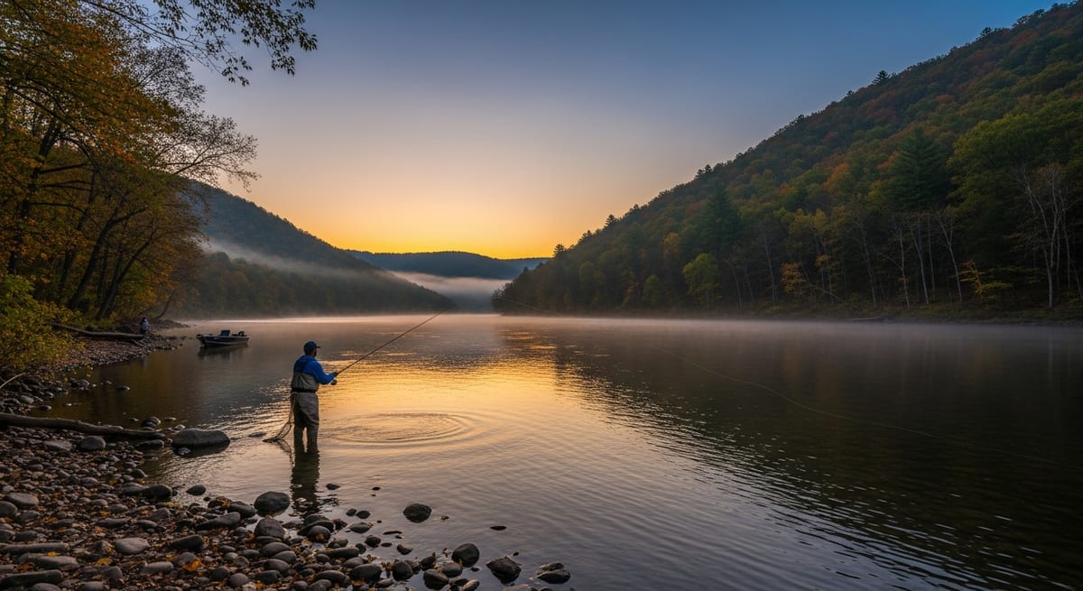
When water temps in the Falls Village gorge are still holding below 60°F in early May, anglers who fish the Housatonic regularly are often already shifting from TMA trout streamers to smallmouth tubes on the rocky downstream runs. A seasonal overlap the Housatonic Fly Fishermen's Association tracks in its spring condition reports but that first-time visitors to the river tend to miss entirely. The Housatonic originates in Massachusetts and runs roughly 60-70 miles through Connecticut, dropping from the cold limestone headwaters of Litchfield County through two significant warm-water impoundments before reaching the tidal lower reach at Derby. That geography creates four functionally distinct fisheries on the same watershed: wild and stocked trout in the TMA section from Route 4 in Cornwall south to West Cornwall, smallmouth bass in the Falls Village gorge, largemouth bass and chain pickerel in Lakes Lillinonah and Zoar, and American shad plus striped bass in the tidal section from Derby to Stratford. CT DEEP's 2025-2026 Freshwater Fishing Guide lists the Housatonic TMA as a special-regulation water requiring a trout/salmon stamp with a 12-inch minimum. A designation that reflects sustained wild-trout management in this section across multiple seasons. Anglers who fish multiple sections regularly describe the Housatonic as four separate trips that happen to share a watershed.
West Cornwall TMA to Falls Village: Wild Trout Regs, DEEP Stocking Windows, and the Gorge Smallmouth CT River Anglers Rate Highly
The Housatonic from Canaan south through Cornwall and Falls Village holds some of the most actively managed trout water in New England. The river runs cold, clear, and rocky, limestone-filtered, producing aquatic insect populations that support wild brown trout and rainbow trout year-round alongside CT DEEP stocking in the spring season.
The Trout Management Area (TMA) runs from Route 4 in Cornwall south to the Covered Bridge in West Cornwall. Per CT DEEP's 2025-2026 freshwater regulations, the TMA requires a trout/salmon stamp and a 12-inch minimum size. A designation that marks it as a managed wild-trout fishery rather than a put-and-take water. The West Cornwall Covered Bridge access off Route 128 and the Cornwall Bridge public area off Route 7 are the most consistently cited entry points in CT fishing forum posts and condition reports covering this section.
Below the TMA, the Falls Village gorge, accessible via the pull-offs on Great Falls Road, holds smallmouth bass that CT river anglers rank among the better river smallmouth fisheries in southern New England, with fish in the 14-18 inch range reported regularly from the rocky runs and deep pools through summer. Tube jigs in crayfish colors, 3-4 inch paddle-tail swimbaits, and beadhead woolly buggers produce fish in the pocket water. Anglers reporting conditions on regional forums note that flows above 400 cfs on the USGS gauge at Falls Village push fish into slower edge seams along the banks.
Lake Lillinonah and Lake Zoar: The Housatonic's Warm-Water Break and What CT Bass Anglers Target by Season
Two significant impoundments interrupt the Housatonic's flow south of Litchfield County, lake Lillinonah (Brookfield/Newtown area) and Lake Zoar (Monroe/Newtown area), and both fish completely differently from the cold upper river. These are warm-water fisheries: largemouth bass, chain pickerel, yellow perch, and some smallmouth hold in water that CT anglers who track the lakes report regularly exceeds 70°F by midsummer.
Lake Lillinonah: Extensive shallow coves and vegetated areas in the upper arms hold largemouth bass from late spring through fall. Rocky channel edges and points produce bass across the season. The chain pickerel population in the weedy backwaters is strong, cT anglers who fish Lillinonah regularly note in trip reports that pickerel are frequently overlooked by bass-focused anglers targeting the same structure. Multiple boat launches and shore access points exist along Routes 133 and 67.
Lake Zoar: Generally clearer water than Lillinonah, with the rocky northern section approaching the Stevenson Dam area producing both smallmouth and largemouth through summer. BASS Nation Connecticut chapter records, which are publicly available, offer one data point on seasonal productivity for anglers planning a first visit.
Both lakes see heavier pressure from Memorial Day through Labor Day. Anglers on regional CT fishing forums consistently report that weekday early-morning launches outperform weekend midday sessions on both lakes by a meaningful margin.
Derby to Stratford: April Shad, May Stripers, and the Tidal Reach CT Anglers Often Fish as a Separate Trip
Below the Derby-Shelton Dam, the Housatonic transitions from fresh to tidal. A shift that produces a completely different set of species and tactics from the upper river. This lower section extends roughly eight miles to the river mouth at Stratford, where the Housatonic meets Long Island Sound.
American shad: CT DEEP's anadromous fish program documents a consistent Housatonic shad run, typically peaking in late April and early May. The Derby and Shelton waterfronts, accessible via public areas off Roosevelt Drive in Derby and the Shelton boat ramp on Bridge Street, produce shad on the outgoing tide as fish push upriver against current. Shad darts in chartreuse and pink, and flutter spoons in the 1/2 to 3/4 oz range, account for most reported catches from this section. Anglers on CT fishing forums note the Derby dam tailwater tends to fish best on a dropping tide as shad stage below the structure.
Striped bass: As the Housatonic widens toward its mouth, stripers move into the tidal section on incoming tides from late April through May and again in September and October. The river mouth near Stratford Point is among the access points CT shore-based striper anglers reference in spring run reports. Bucktail jigs with white or chartreuse trailers, needlefish plugs, and live river herring account for most fish reported by CT anglers working this section on moving water.
Wading the TMA and Gorge: What CT Regulars Say About the Limestone Bottom, Flow Variability, and Boot Requirements
The TMA section from West Cornwall to the covered bridge, and the gorge section below Falls Village, are the Housatonic's most productive wading water. River width runs 50-100 feet through most of these reaches, and reaching mid-river structure typically requires wading out to the current seams rather than fishing from the bank.
The limestone bedrock that creates the cold, mineral-rich water that holds trout also produces a notoriously slick wading surface by midsummer, when algae growth coats exposed rock. CT anglers who wade this section regularly cite cleated or carbide-studded wading boots as effectively mandatory once temperatures climb in July and August. Felt soles are prohibited on Connecticut waters under the state's aquatic invasive species regulations, verify current CT DEEP footwear requirements before outfitting for a first trip to this section.
A wading staff is cited frequently by experienced Housatonic waders as useful insurance at flows above 350-400 cfs on the Falls Village USGS gauge. The CT DEEP maintains public access areas along Route 7 through Litchfield County, pull-offs near the West Cornwall Covered Bridge and the Cornwall Bridge fishing area are the most accessible entry points for wading day trips from the shoreline counties.
Paddling the Housatonic: Where CT Kayak Anglers Access Structure That Wade Anglers Can't Cover
Fishing the Housatonic from a canoe or kayak significantly expands access to mid-river structure, particularly in the Cornwall/West Cornwall TMA section where portions of the river run too deep to wade comfortably. CT kayak anglers who float the upper river in spring report reaching holding lies for trout and smallmouth that are unreachable for waders working from the bank.
Cornwall/West Cornwall section: Multiple access points support float trips of 3-8 miles through the TMA. CT DEEP regulations apply to anglers on the water regardless of access method, tMA stamp and size limit requirements hold whether fishing from a kayak or wading.
Falls Village gorge: The Class II-III rapids through the gorge require paddling experience and are typically approached as a wade-in from the Great Falls Road access rather than a through-float. The consensus among anglers who fish this section is that stationary wading positions produce better results in the gorge runs than floating through.
Lake Lillinonah kayak access: Multiple launch sites support kayak bass fishing on the impoundment, and the quiet approach of a kayak is noted by CT bass anglers as an advantage in the shallower coves where powerboat traffic pushes fish off structure.
The Housatonic Fly Fishermen's Association (HFFA) publishes current river conditions and access updates on its website, and CT DEEP's online access map is the recommended resource for verifying launch availability and any seasonal closures before a trip.
EVERY SATURDAY MORNING
Weekly fishing intelligence
Nationwide conditions, what's biting, and honest gear deals. One email, no noise.
No spam. Unsubscribe anytime.