
Striped Bass Migration Tracker
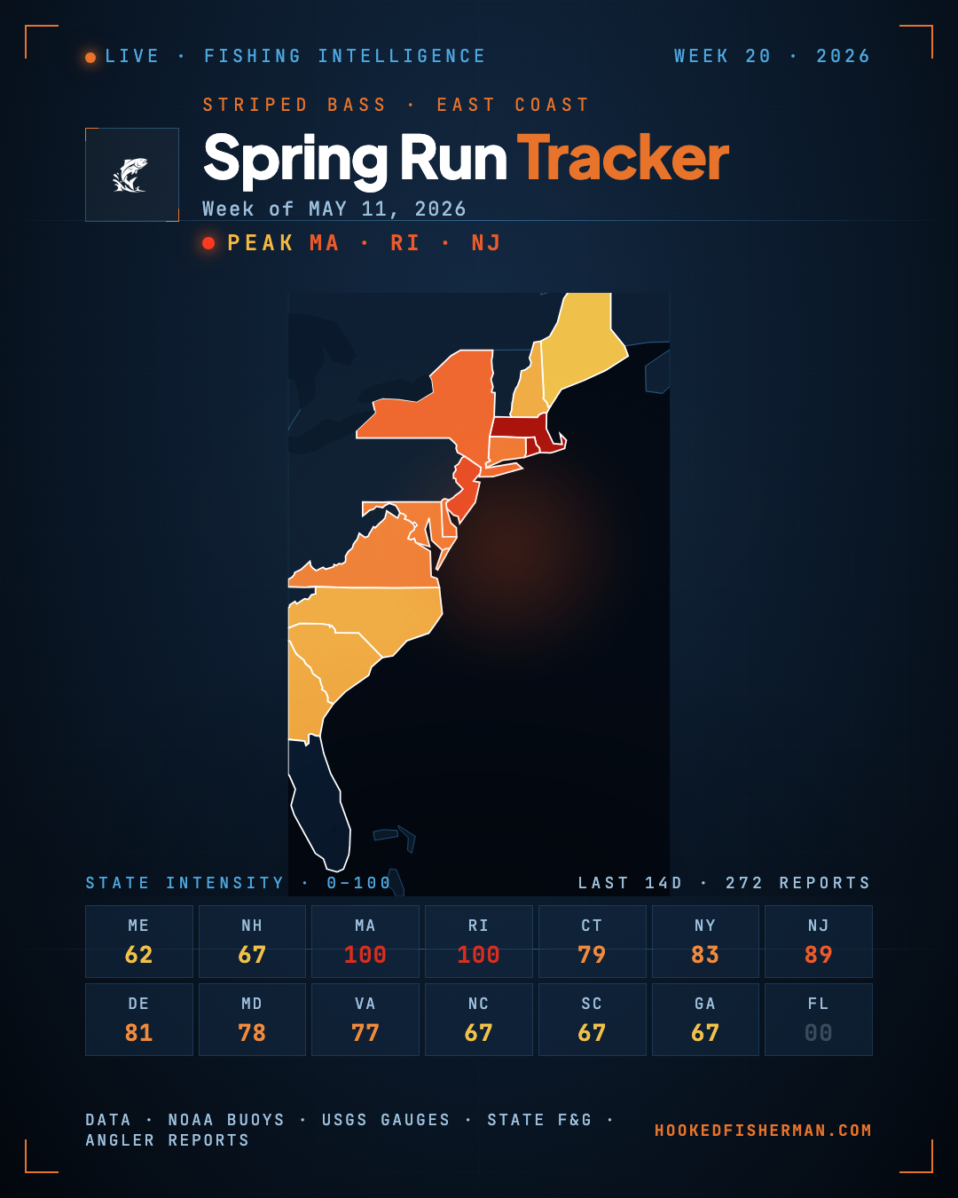
Where the stripers are right now, from Maine to Florida. We score every fishing report that mentions striped bass, stripers or rockfish, then map the result. A new map goes up each week and the old ones stay below, so you can watch the run move down the coast instead of guessing where it got to.
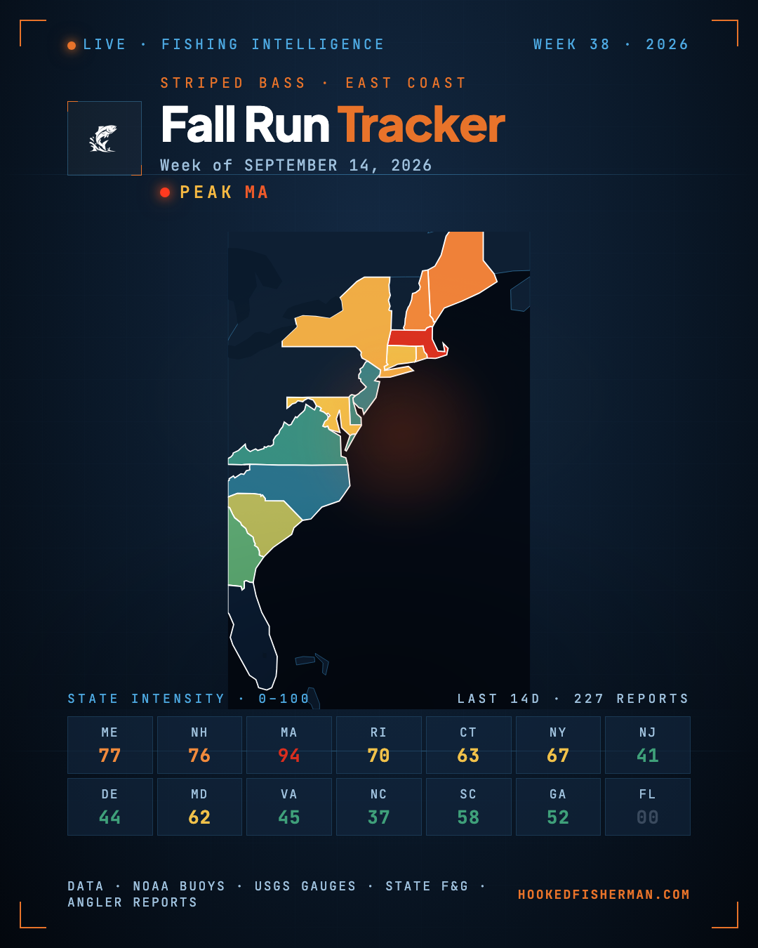
State by state, north to south
Scored from every saltwater striped bass report we collected in the last 14 days. 11 of 16 coastal states are currently reporting stripers.
| State | Status | Where | Reports | Latest |
|---|---|---|---|---|
| Maine | Hot | Gulf of Maine | 8 | Sep 15 |
| New Hampshire | Hot | Gulf of Maine (NH coast) | 8 | Sep 16 |
| Massachusetts | Hot | Cape Cod Bay, Buzzards Bay & Vineyard Sound | 18 | Sep 15 |
| Rhode Island | Hot | Narragansett Bay | 8 | Sep 15 |
| Connecticut | Active | Long Island Sound | 8 | Sep 15 |
| New York | Active | Long Island & Montauk | 9 | Sep 14 |
| New Jersey | Active | Raritan Bay & Sandy Hook, Jersey Shore, Delaware Bay (NJ side) | 36 | Sep 15 |
| Pennsylvania | No striper reports | — | — | — |
| Delaware | Active | Delaware Bay | 6 | Sep 10 |
| Maryland | Active | Chesapeake Bay | 8 | Sep 16 |
| District of Columbia | No striper reports | — | — | — |
| Virginia | Active | Chesapeake mouth, Eastern Shore (Chincoteague) | 15 | Sep 15 |
| North Carolina | No striper reports | — | — | — |
| South Carolina | No striper reports | — | — | — |
| Georgia | Slow | Georgia Atlantic Coast | 1 | Sep 14 |
| Florida | No striper reports | — | — | — |
“No striper reports” means nobody we collect from mentioned striped bass in that state’s salt water this fortnight. It does not mean the fish are not there. It means we have nothing to show you, and we would rather say so than draw an empty map and call it data.
Inland striper fisheries
Striped bass are stocked in reservoirs well away from the coast, and those fish do not migrate. They are kept out of the table above so it stays a picture of the coastal run, but they are fishing, and here is where they are biting.
- SlowMaineKennebec & Penobscot, Moosehead Lake & upper Penobscot
- SlowNew JerseyDelaware River & Pine Barrens
- SlowPennsylvaniaLake Erie & Presque Isle
- ActiveVirginiaSmith Mountain Lake & Buggs Island
- ActiveNorth CarolinaCatawba & Roanoke
- ActiveSouth CarolinaSantee & Lake Murray
- ActiveGeorgiaLake Lanier & Allatoona, Lake Hartwell & Russell (Savannah chain), Chattahoochee & Savannah
Wayfinder
Planning a striper trip?
Wayfinder builds a plan around the water you are fishing, the species you are after and the conditions that week.
The weekly archive
Every map we have published, newest first. 21 weeks on record.
- September 14, 2026
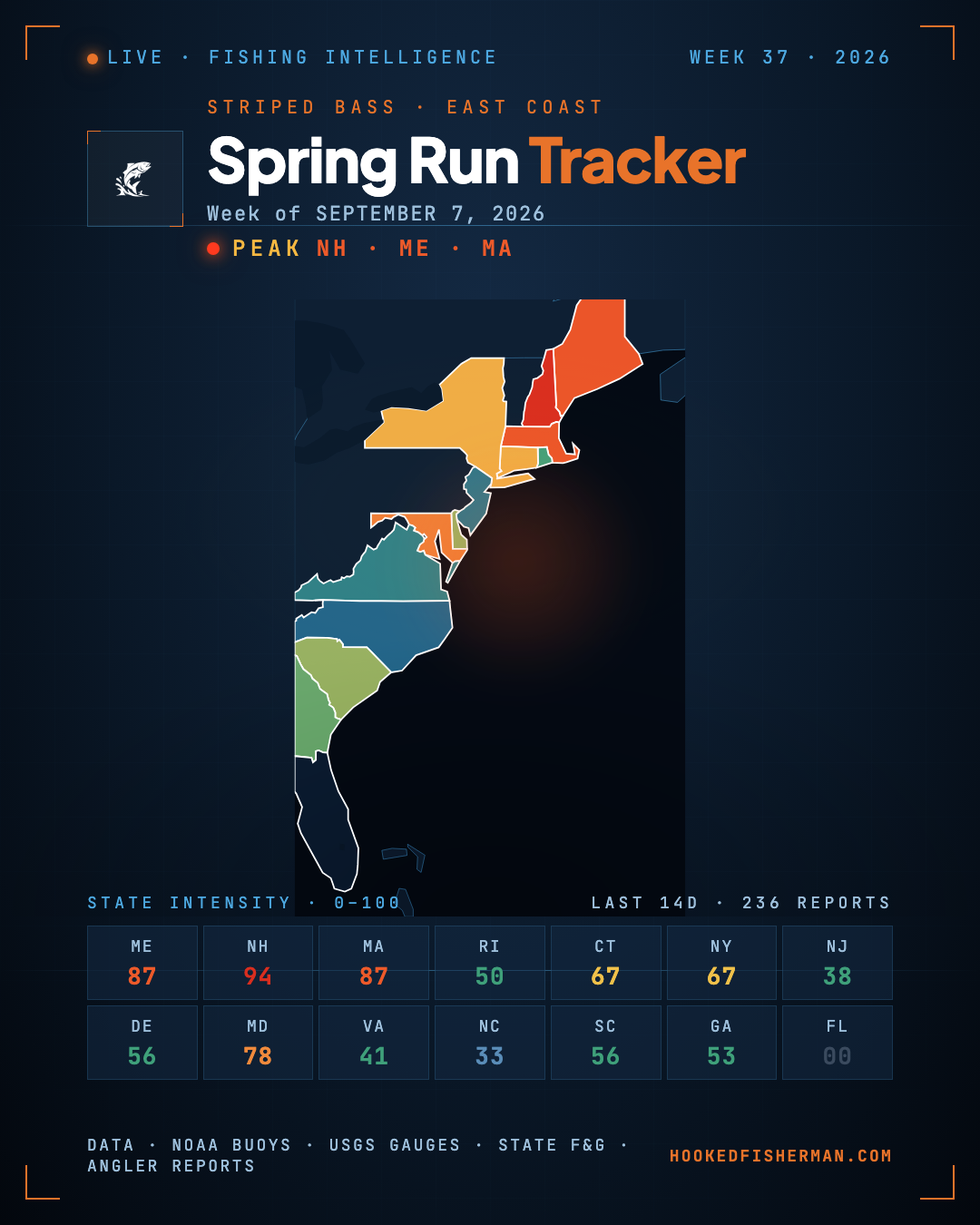 September 7, 2026
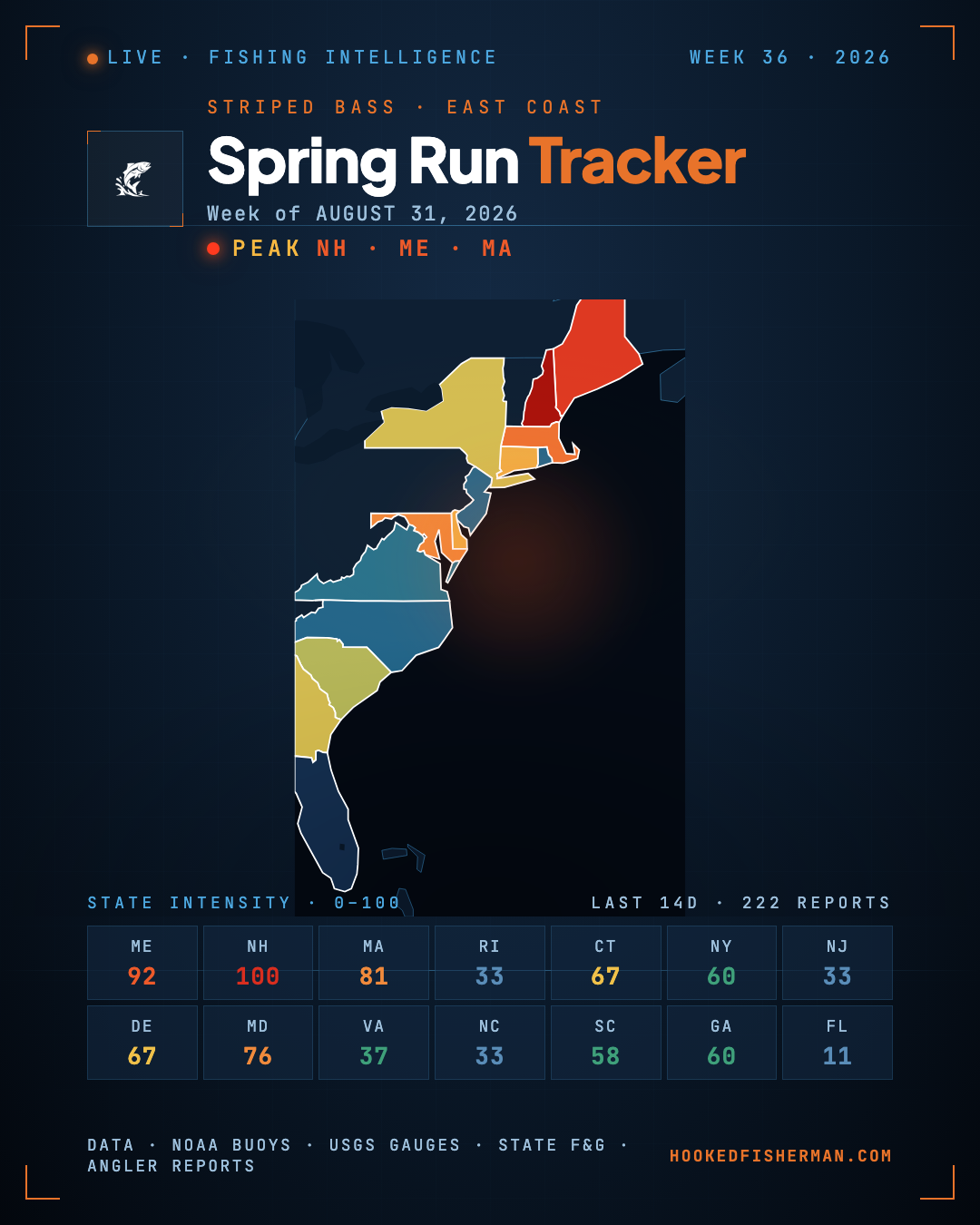 August 31, 2026
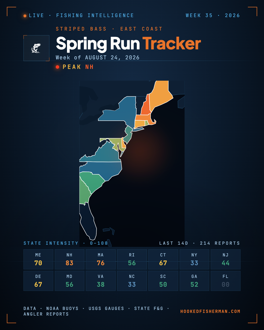 August 24, 2026
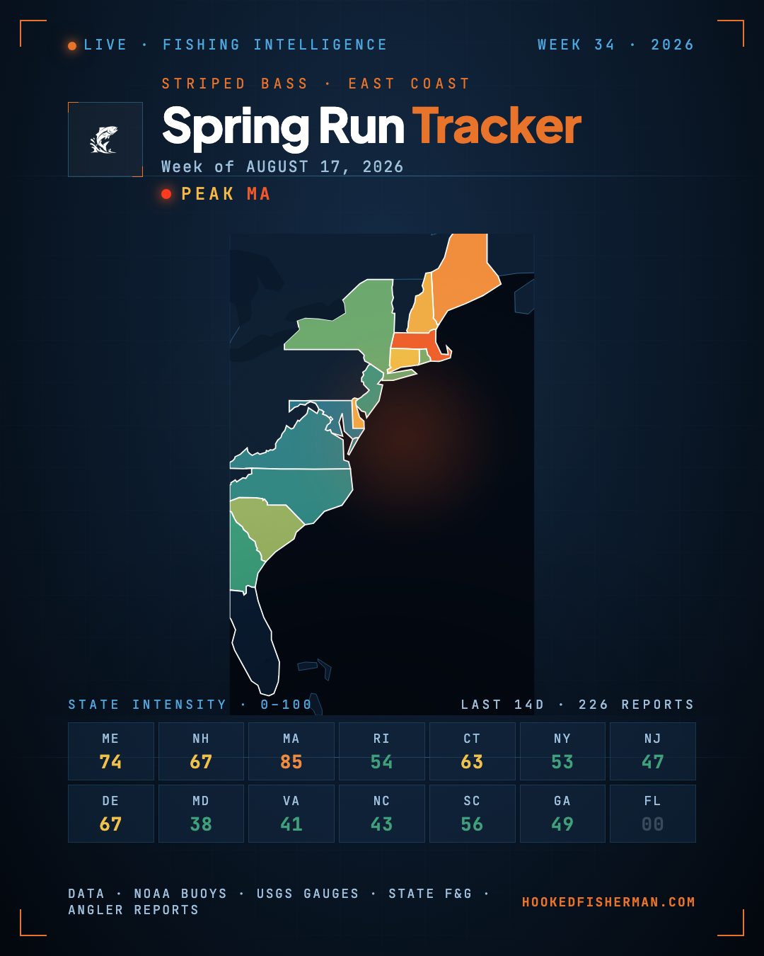 August 17, 2026
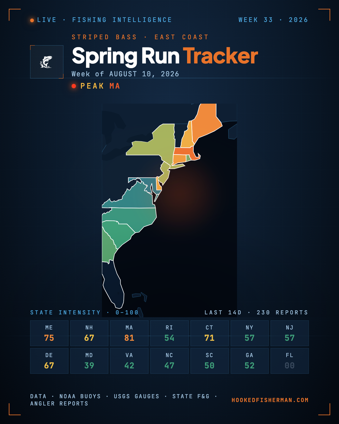 August 10, 2026
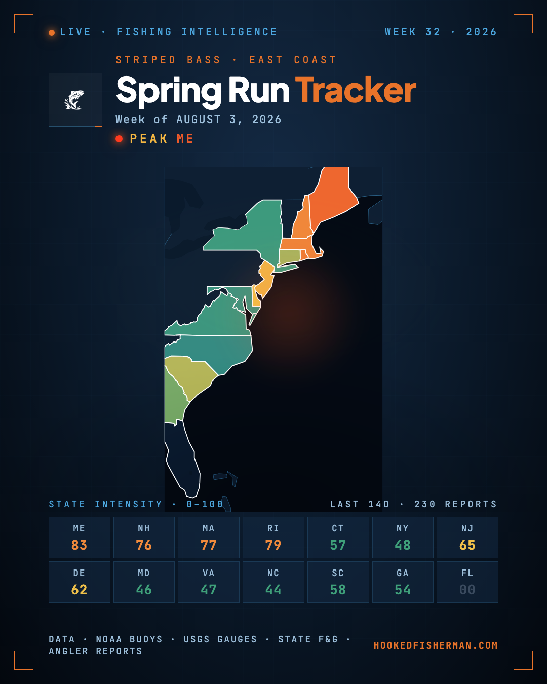 August 3, 2026
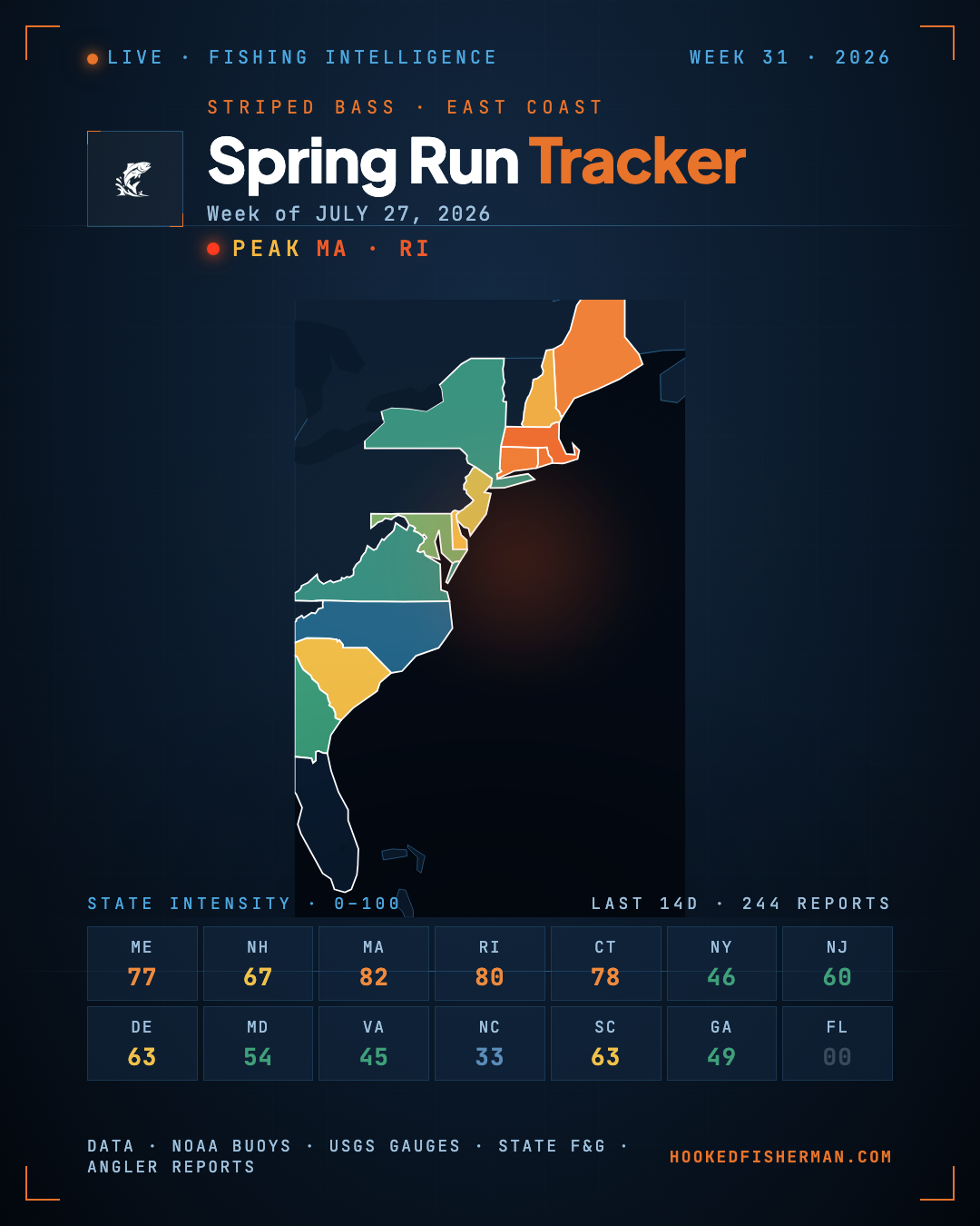 July 27, 2026
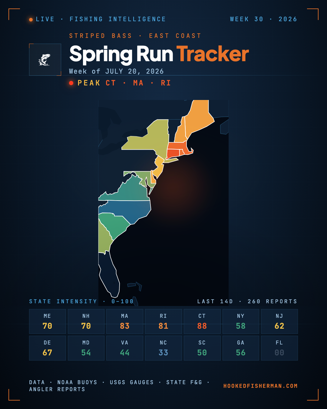 July 20, 2026
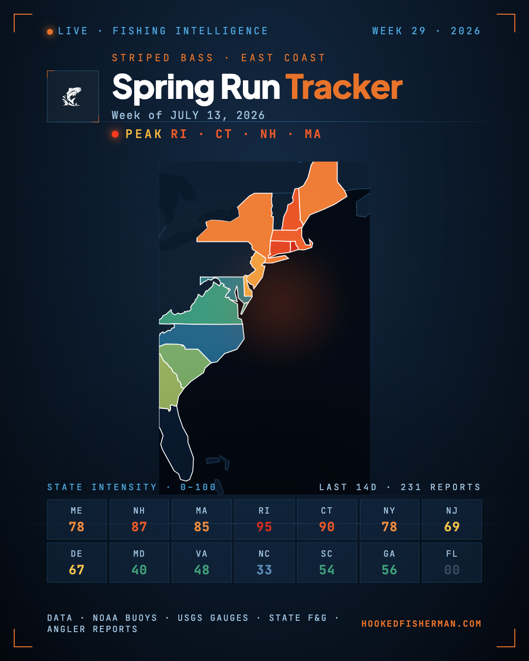 July 13, 2026
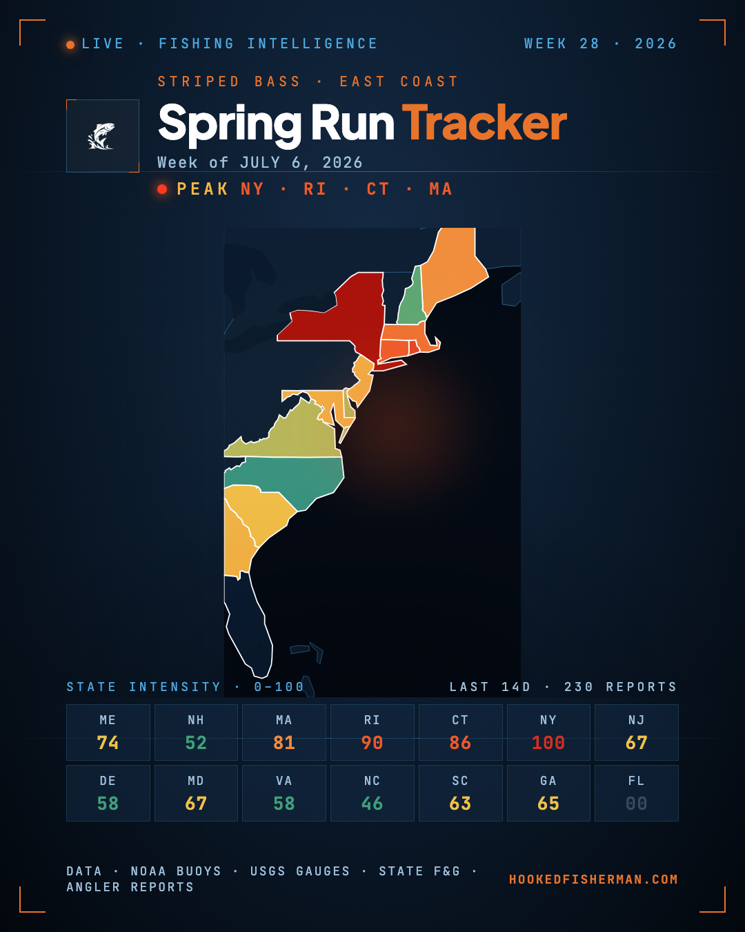 July 6, 2026
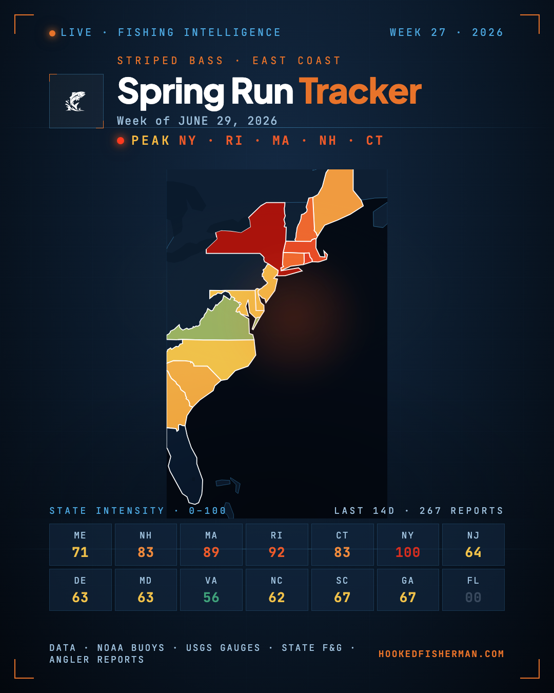 June 29, 2026
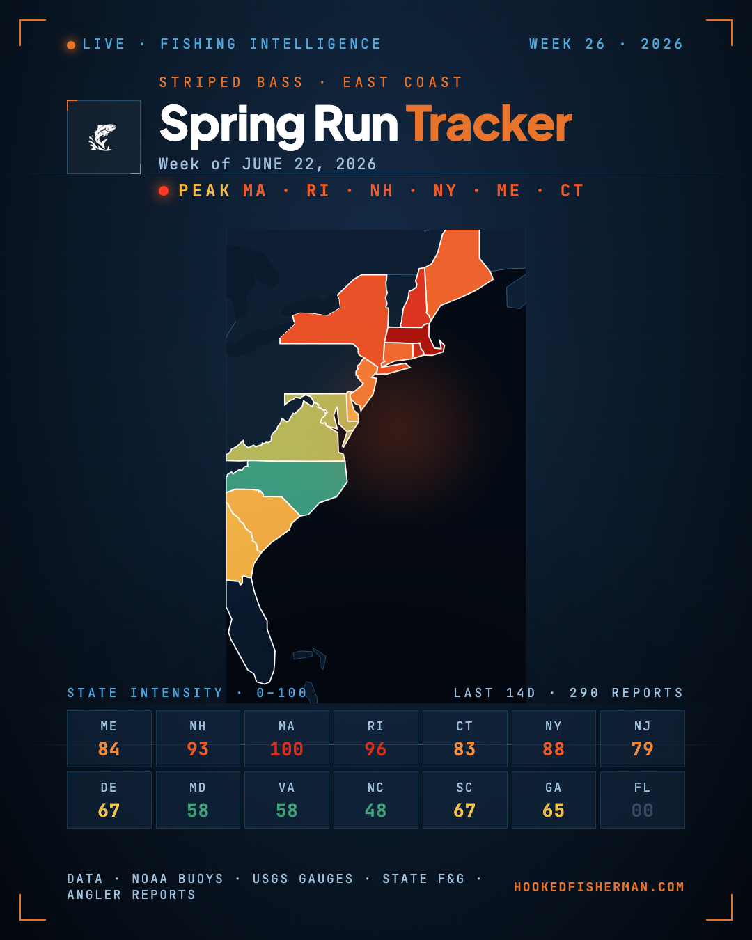 June 22, 2026
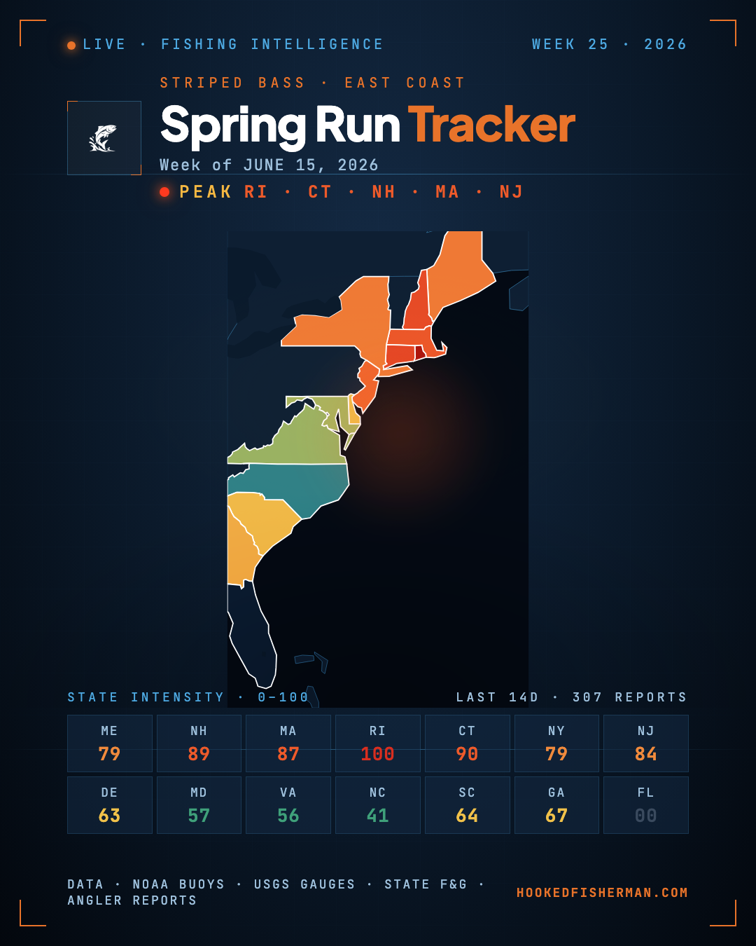 June 15, 2026
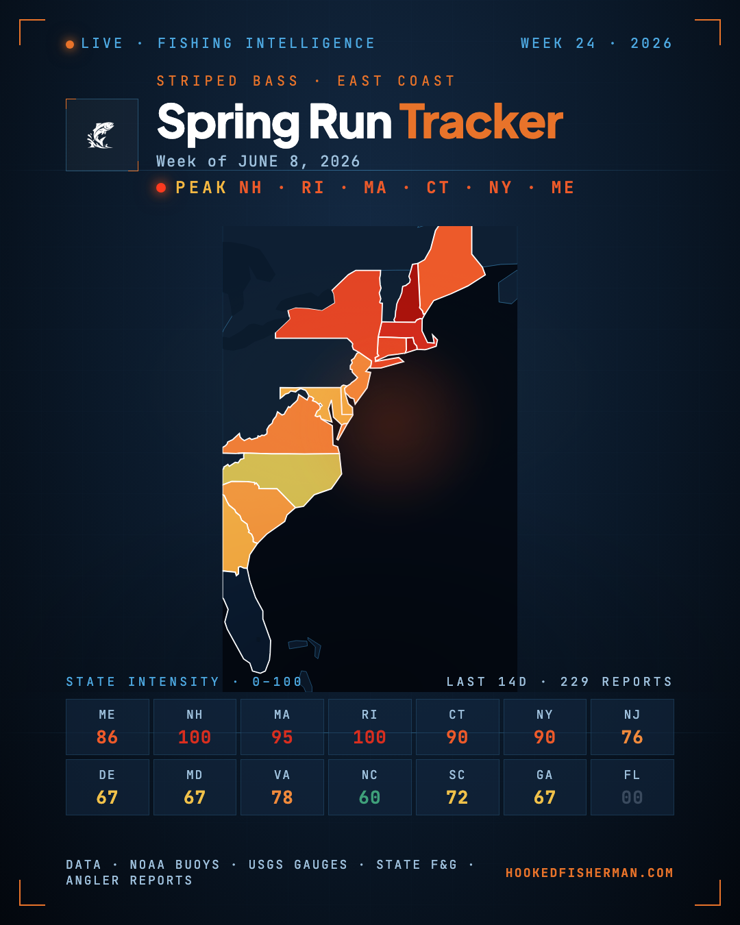 June 8, 2026
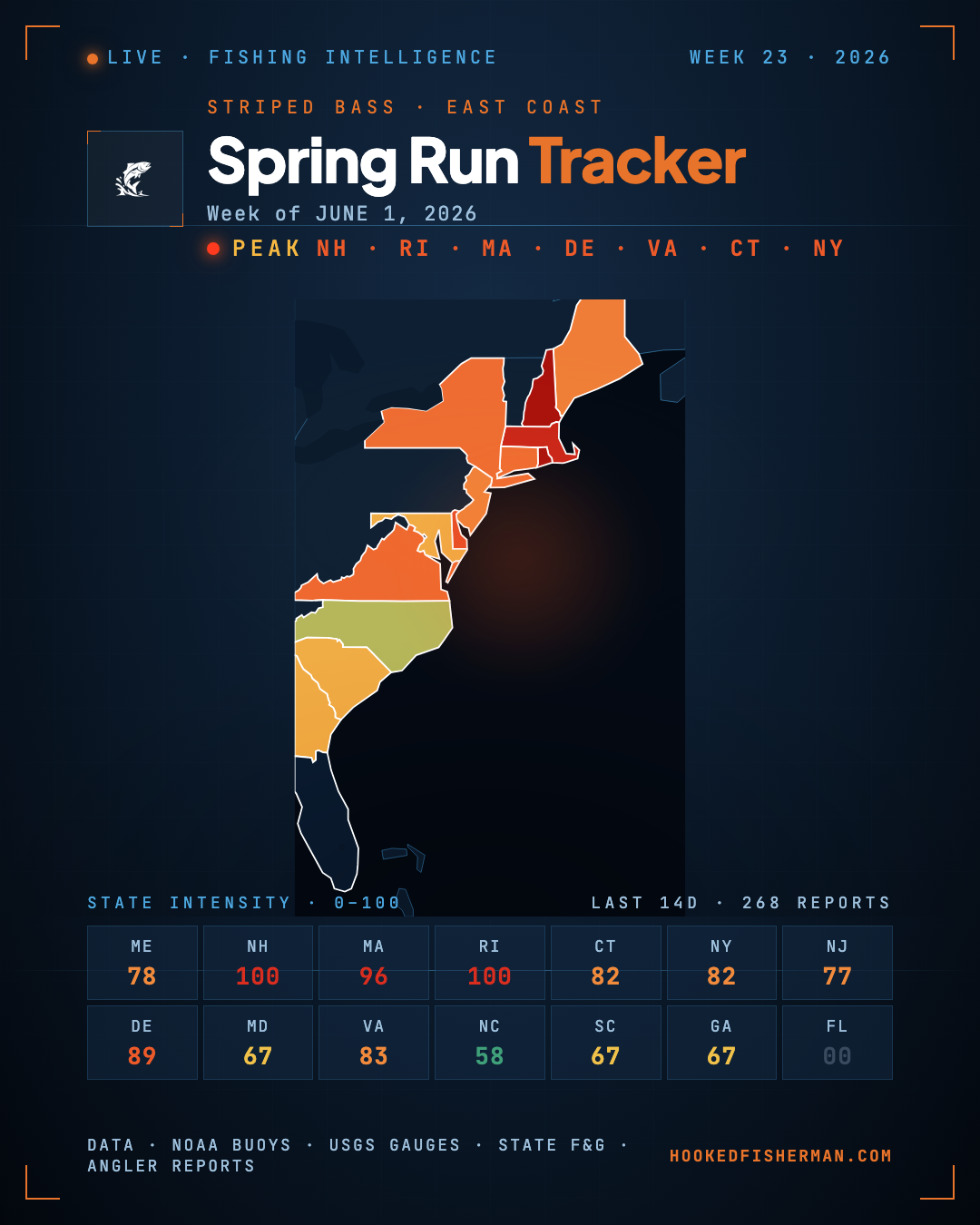 June 2, 2026
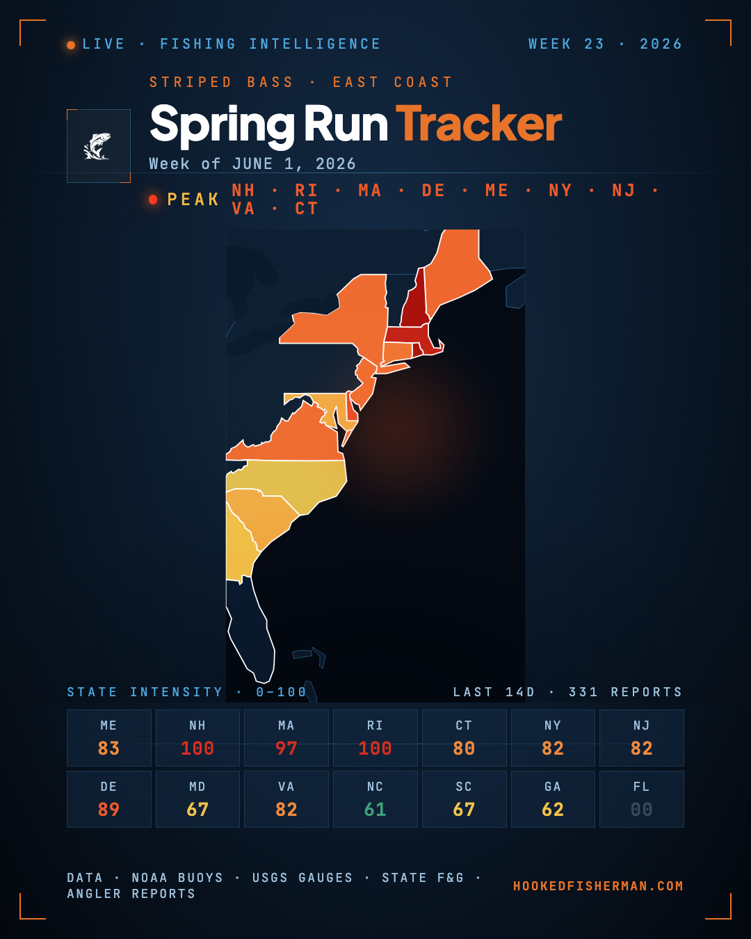 June 1, 2026
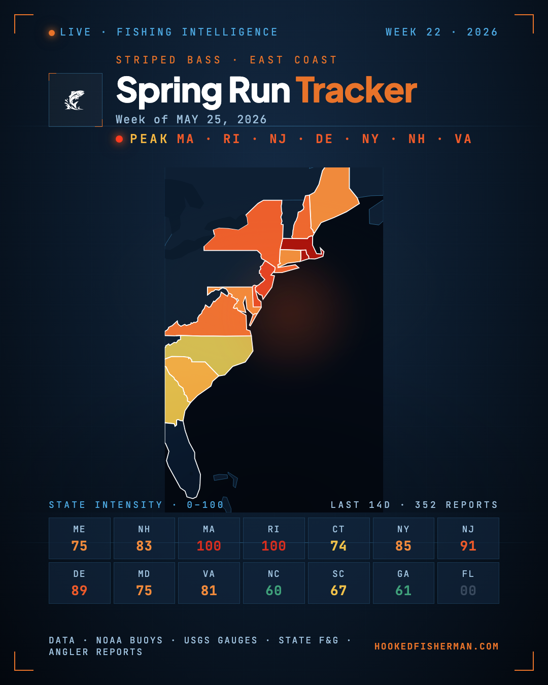 May 25, 2026
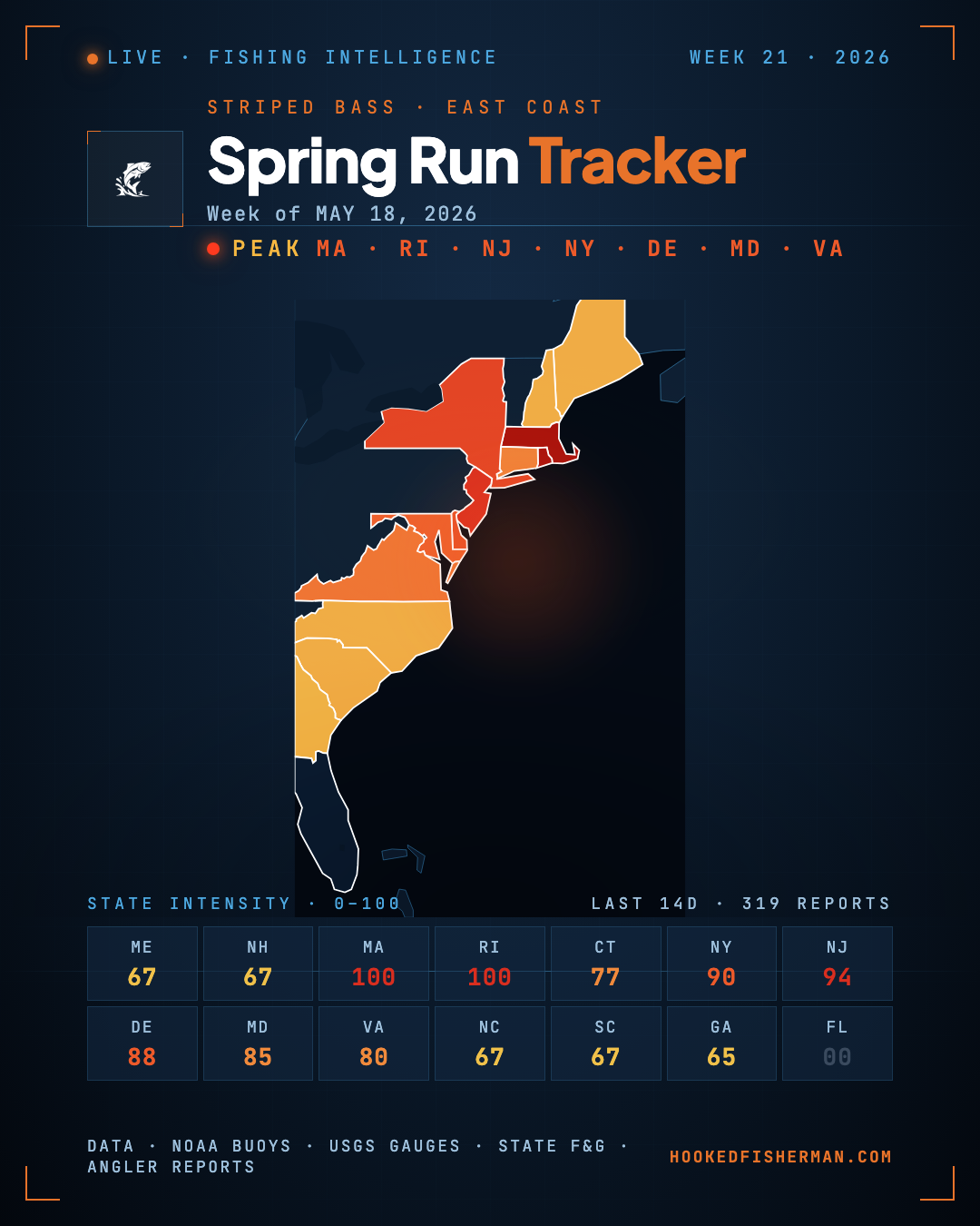 May 18, 2026
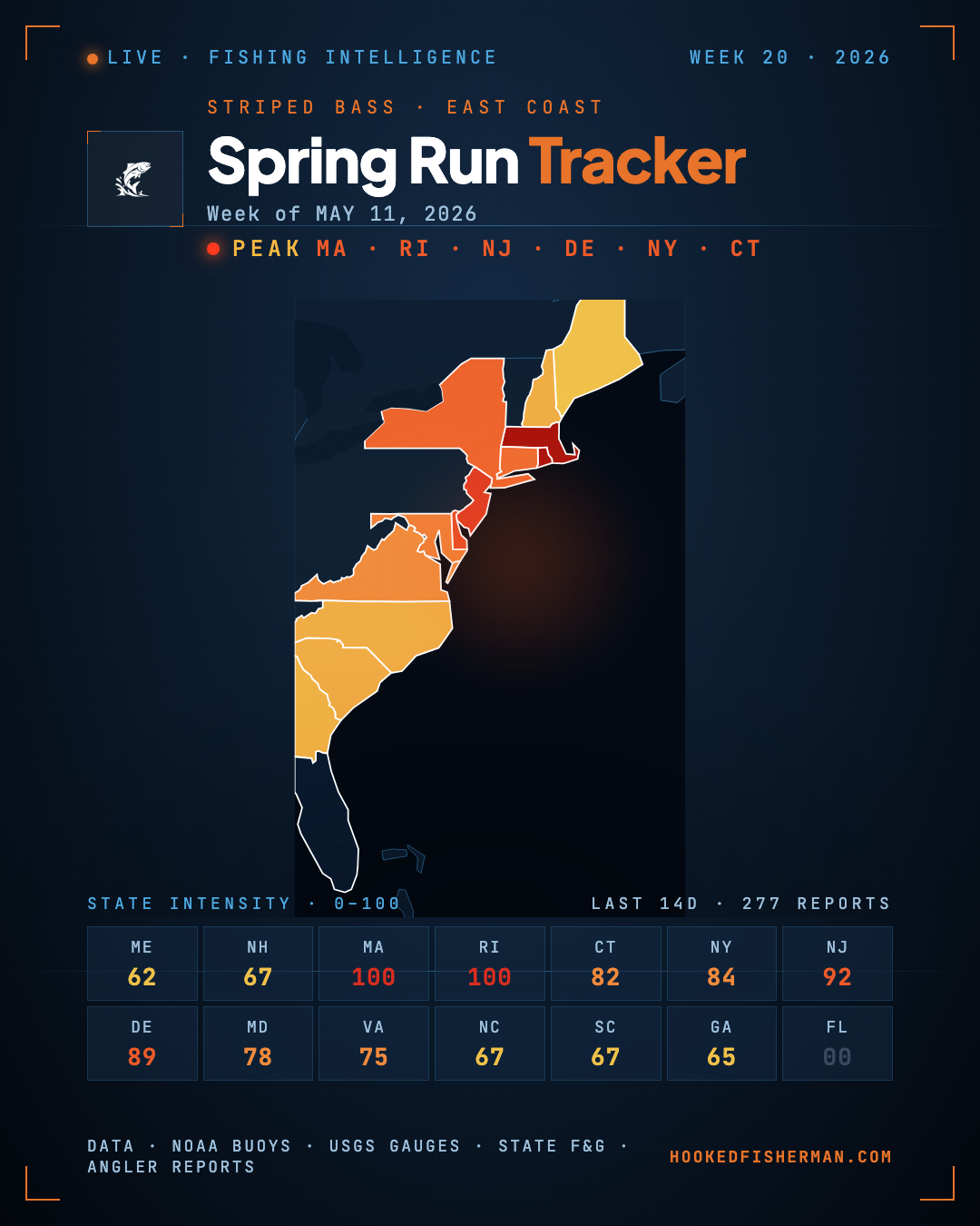 May 14, 2026
 May 13, 2026
How this is built
Every fishing report we collect is scanned for striped bass, stripers and rockfish. A report that tags the species with a condition (“hot”, “slow”) scores on that condition; a report that only mentions the fish in passing counts as presence, weakly. The strongest report in a state sets that state’s color.
We do not model the migration or predict where the fish will be next week. This is a picture of what anglers and shops actually reported, which is a smaller claim and one we can stand behind.
Live status last read September 16, 2026.
EVERY SATURDAY MORNING
Weekly fishing intelligence
Nationwide conditions, what's biting, and honest gear deals. One email, no noise.
No spam. Unsubscribe anytime.