
The Ebb at an Inlet Mouth Fishes Differently Than the Flood on a Tidal Flat. How CT Shore Anglers Use Long Island Sound's Tidal Stages, and the Regulations Every Striper Trip Requires
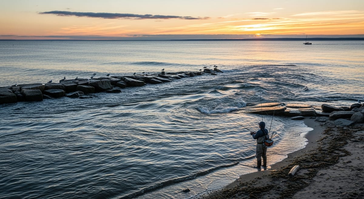
Surf anglers fishing the mouth of the Niantic River consistently report that the striper bite peaks about an hour into the ebb, not at high water, where most newcomers set up. That timing shows up at most inlet-mouth spots along the Connecticut shore, and it traces to basic tidal physics: how Long Island Sound's twice-daily tidal cycle drains water through predictable exits, concentrates baitfish, and pulls feeding fish into current seams. The difficulty is that the same tidal stage that fires at an inlet mouth often does nothing on a tidal flat, and the flooding tide that draws stripers onto the flats can be the slowest phase at a river mouth. Before any trip: CT DEEP sets the striped bass slot limit and daily creel under ASMFC management. As of the 2025 season, the recreational slot was 28 to 35 inches, one fish per angler per day. Season dates and limits have tightened in recent years, download the current CT Saltwater Fishing Guide at ct.gov/deep or pick one up at a tackle shop before the season opens.
How Long Island Sound's Tidal Cycle Works, and Why the Range Differs Across the Shore
Long Island Sound follows a semi-diurnal tide pattern: two high tides and two low tides every 24 hours. The cycle repeats every 12 hours and 25 minutes, which means tide times shift roughly 50 minutes later each day. A favorable outgoing window at 9 AM this week becomes a noon window next week. Anglers who fish the same spots through a season internalize this calendar quickly.
Tidal range: the vertical difference between high and low water, varies across the CT coast. NOAA tide gauge data shows the western Sound (Bridgeport, Stamford, Greenwich) typically runs larger tidal ranges than the eastern end near New London and Mystic, where the Sound's geometry changes as it opens toward the Atlantic. The exact range on any given day at any specific gauge is more reliably read from NOAA Tides and Currents (tidesandcurrents.noaa.gov) than from any general rule.
The four tidal stages:
- High water: The tide at its peak; water near slack. A transition period at most spots. The current has stopped moving and fish that were feeding often pause or scatter.
- Outgoing (ebb): Water draining from inlets, estuaries, salt ponds, and backwaters back to the Sound. At most inlet-mouth spots on the CT shore, this is the primary productive phase.
- Low water: The tide at its minimum, near slack again. Similar to high water, another transition period.
- Incoming (flood): Water flowing in from the Sound. Productive in specific ways at specific locations, tidal flats, salt pond entrances, and river channel edges. That differ from the ebb.
Why CT Surf Anglers Prioritize the Outgoing Tide at Inlet Mouths
At the inlet mouths and channel narrows that define most of Connecticut's publicly accessible saltwater structure, the outgoing tide is the phase most CT surf anglers build their trips around. The reasoning is consistent with what anglers fishing these spots report across seasons.
Baitfish concentration: As the tide drops, shallow water in marshes, coves, and backwaters drains through a limited number of exits. Baitfish scattered across the flat funnel toward those exits, suddenly concentrated and moving in a predictable direction. Stripers and bluefish position at the exit points and feed on bait that has few options for escape.
Current seams: The outgoing tide creates defined current lines at inlet mouths. A striper holding on the slack-water edge of a strong ebb current intercepts everything sweeping past with minimal effort. The consensus among CT surf anglers who fish inlet mouths regularly is that the mid-ebb window, when current velocity peaks, roughly halfway through the drop, produces the most reliable action.
Mid-ebb versus first-of-ebb: Not every spot peaks at the same phase. Anglers fishing the Niantic River mouth report the bite often fires early in the ebb as soon as the first real current builds, while spots on the lower Housatonic tend to run better deeper into the drop when channel current builds through the deeper sections. Local knowledge from a nearby tackle shop or a few seasons of attention to a specific spot calibrates the general rule.
Oxygenation: Moving water carries more dissolved oxygen than slack water. Saltwater species tend to be more active in well-oxygenated, moving water. A reinforcing factor at tidal structure regardless of flow direction.
The Flooding Tide: Tidal Flats, Salt Ponds, and the CT Spots Where the Rule Flips
The outgoing-tide rule holds at inlet mouths. On tidal flats and salt pond entrances, the flood tide is often the better window, and CT anglers who work the Sound's shallower areas treat the two phases as completely separate opportunities.
Tidal flats: Sandy and muddy flats that drain nearly dry at low water refill on the incoming tide. Stripers and weakfish push onto these flats as water covers the bottom, feeding on crabs, shrimp, and small baitfish that emerge from the substrate. Anglers fishing flat stretches around Hammonasset Beach State Park (Madison, parking off Route 1 and Meig's Point Road) report tailing fish in less than two feet of water on a good flooding tide. A sight-fishing situation that has no equivalent during the outgoing phase.
Salt ponds and breachway entrances: Coastal ponds connected to the Sound via narrow channels fill on incoming tides. Predators and baitfish push through the single entrance together, and the confined entry creates predictable structure anglers can position against. Several ponds along the eastern CT shore produce reliably on the flood precisely because the narrow entrance concentrates action into one fishable point.
Tidal rivers: The tidal reach of the Connecticut River (Old Saybrook to Essex), the lower Housatonic (Milford and Stratford), and the Thames River (New London and Groton) produce on both tidal phases, but the flood often pushes stripers deeper into the channels as baitfish move with the current. Anglers fishing the Connecticut River mouth at Old Saybrook report stripers staging on the downstream shoals during the flood, waiting for bait to sweep past.
Access: The Connecticut River mouth area is accessible from Pilgrim Landing boat launch in Old Lyme and from shore at Great Island Wildlife Management Area (foot traffic only; no vehicles past the gate). The lower Housatonic is accessible from shore at Milford Point and from the Housatonic River WMA launch in Stratford.
Reading the NOAA Tide Tables for Your CT Shore Spot
Tide tables list predicted high and low water times and heights for reference gauge locations. For Connecticut, NOAA maintains gauges at Bridgeport, New Haven, Old Saybrook, New London, and Mystic, among others.
NOAA Tides and Currents: The free NOAA site (tidesandcurrents.noaa.gov) provides tide predictions for all official gauge stations. Search by location, select the nearest CT gauge, and the daily table shows high and low water times with predicted heights in feet.
Interpreting a table entry:
- High water at 8:15 AM, height 5.4 ft; low water at 2:30 PM, height 0.2 ft, tidal range that day is 5.2 feet. Higher range typically means stronger current at tidal structure.
- The outgoing phase runs from the 8:15 AM high toward the 2:30 PM low, roughly six hours of falling water.
- Mid-ebb in that example falls around 11:15-11:30 AM, when current velocity typically peaks.
Fishing apps: Navionics includes tide and current overlays and is consistently maintained. Most dedicated fishing apps display tide charts alongside solunar information. The app Fishidy has had intermittent maintenance issues in recent years. Anglers recommend cross-checking its tide data against the NOAA website for your specific gauge before relying on it for trip planning.
Location corrections: A gauge at New London may not precisely match tide timing at a nearby cove or inlet. Tides at a specific spot can run 20-40 minutes earlier or later than the reference gauge. Tackle shop staff near your target spots often know these local corrections. That specificity is worth asking about.
Moon Phase, Solunar Periods, and the Full-Moon Window on the Sound
Beyond the daily tidal cycle, moon phase and lunar position create additional feeding patterns that CT surf anglers layer on top of their tide planning.
Moon phase:
- New moon and full moon: Generate "spring tides", maximum tidal range, strongest currents. CT surf anglers who fish inlet mouths on the Sound consistently describe full moon weeks as the best combination of large tidal range and active fish. Overnight striper sessions during the full moon at the Sound's larger inlets carry a strong reputation among the region's surf fishing community.
- First and third quarter moon: Generate "neap tides", smaller tidal range, weaker current at current-dependent spots.
Solunar tables: Solunar feeding predictions, based on the moon's position directly overhead or underfoot, have been used by anglers for decades. The concept was formalized by John Alden Knight in the mid-twentieth century. The predictions generate major periods (typically two per day, roughly two hours each) and minor periods at moonrise and moonset (roughly one hour each).
How much weight to put on them: Solunar tables correlate loosely with feeding activity in a way that many experienced anglers find useful, but not in isolation. A major solunar period in flat, slack-tide conditions with no bait around changes nothing. The combination CT surf anglers describe as most productive is outgoing tide peak at an inlet mouth, full moon week, overlapping a major solunar period. When those three align, experienced Sound anglers treat it as a priority date.
Free tools: Most fishing apps display solunar tables alongside tide charts. Cross-check the outgoing tide peak at your target spot against the solunar calendar, when they overlap, note the date.
How CT Shore Anglers Combine Tidal Stage, Moon Phase, and the Slot Limit Into a Single Trip Plan
Step 1: Pick your spot type first, not the spot. Inlet mouth → plan around the outgoing. Tidal flat → plan around the incoming. River channel → both phases produce, but at different locations within the channel. Let the tidal stage dictate the spot.
Step 2: Look up the tide table for your reference gauge. Use NOAA Tides and Currents for the nearest CT gauge, bridgeport, New Haven, Old Saybrook, or New London. Identify the phase that matches your spot type and note when current peaks.
Step 3: Arrive before the window. The best feeding often starts 30-60 minutes before the predictive peak. Anglers who fish the Niantic inlet, the Connecticut River mouth, and similar tidal structure consistently recommend being rigged and in position before the current builds, not arriving at the theoretical start of the prime phase.
Step 4: Layer in moon phase. Full moon and new moon weeks produce the largest tidal range and strongest currents at inlet-mouth spots. The difference in current strength between a spring tide and a neap tide week is real at any spot where current is the key variable.
Step 5: Know the regulations before any fish touches the cooler. As of the 2025 season, CT's recreational striped bass slot was 28 to 35 inches, one fish per angler per day, under ASMFC management. Season dates apply. Verify the current year's rules at ct.gov/deep, limits have changed in recent seasons and are likely to continue evolving with the stock.
A worked illustration (these are not real tide data, check NOAA for your actual target date): Suppose you're planning an outgoing-tide trip to the Niantic River mouth. The tide table for your date shows high water around 9 AM and low water around 3 PM. Your target window is roughly 8:30 AM through 2:30 PM, fishing hardest from mid-morning when current builds. On a full moon week, you check the solunar calendar and see a major period in the late-morning range. Being in position before 9 AM, fishing hardest during the overlap of peak current and that solunar window, is the approach CT surf anglers fishing tidal inlets describe as reliably producing results, when conditions cooperate. The specific times above are hypothetical; always pull the actual NOAA table for your date and gauge.
EVERY SATURDAY MORNING
Weekly fishing intelligence
Nationwide conditions, what's biting, and honest gear deals. One email, no noise.
No spam. Unsubscribe anytime.